Топогеодезия СК-42 light 2.9.3
Free Version
Publisher Description


Calculations of field topography in full or abbreviated coordinates, in one or in adjacent areas.
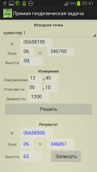
Rectangular coordinates and heights in meters.
Angles of directions and places in thousandths on a scale of 60-00 or 64-00. In OGZ and PGZ, the angles are also in degrees-minutes-seconds.
Maintaining a list of items whose data can be used in tasks (250). Saving data to a file / reading and adding data from a file. The file in xml / txt can be edited / prepared in text editors.
(Google / ArcGIS / TopBox / Off-line atlases) with point markers from the list (only with full coordinates).
Google Map is cached for offline use.
TopBox with Off-line manager in which you can load the visible area with the selected zoom levels. Maximum downloadable tiles maps 6000.
Atlases for off-line use in *. mbtiles can be created in SAS Planet, MobAC (only available in the full version).
When you touch the map, rectangular (in SK-42) and geodetic coordinates of the place are shown.
Coordinate grid (1 or 2 km) in SK-42. It is built around the first point on the list, 40x40 km.
Measuring distances on the map.
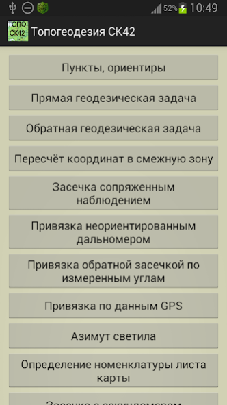
Composition of tasks:
- direct geodetic problem;
- inverse geodetic problem;
- recalculation of coordinates to an adjacent zone;
- sniffing by conjugate observation;
- binding with an undirected rangefinder;
- snapping by resection along the measured angles;
- referencing according to GPS data (geodetic and rectangular).
- azimuth of the star at a given time. For the Sun, for the Polar Star;
- nomenclature of the map sheet (specified scale for specified coordinates);
- notch with a stopwatch (taking into account the air temperature), screen stopwatch.
On the main menu screen to select
- scales of thousandths,
- Map service (Google, ArcGIS, Mapbox, Offline Atlas)
- interface color style
- the type of point markers on the map
- temperature (C / F)
- saving data to a file / reading and adding data from a file.
Free (light) version limitations:
- a list of 4 points (instead of 250);
- on the map a small area of the grid;
- several tasks and functions are disabled.
- no work with off-line atlases.
The free version also has some ads.
The program is distributed "as is". Its use is at the discretion and responsibility of the user.
About Топогеодезия СК-42 light
Топогеодезия СК-42 light is a free app for Android published in the Geography list of apps, part of Education.
The company that develops Топогеодезия СК-42 light is NordSoft. The latest version released by its developer is 2.9.3.
To install Топогеодезия СК-42 light on your Android device, just click the green Continue To App button above to start the installation process. The app is listed on our website since 2022-06-13 and was downloaded 2 times. We have already checked if the download link is safe, however for your own protection we recommend that you scan the downloaded app with your antivirus. Your antivirus may detect the Топогеодезия СК-42 light as malware as malware if the download link to nordsoft.topoSK42_light is broken.
How to install Топогеодезия СК-42 light on your Android device:
- Click on the Continue To App button on our website. This will redirect you to Google Play.
- Once the Топогеодезия СК-42 light is shown in the Google Play listing of your Android device, you can start its download and installation. Tap on the Install button located below the search bar and to the right of the app icon.
- A pop-up window with the permissions required by Топогеодезия СК-42 light will be shown. Click on Accept to continue the process.
- Топогеодезия СК-42 light will be downloaded onto your device, displaying a progress. Once the download completes, the installation will start and you'll get a notification after the installation is finished.
